Performance & Transparency

The GIS Department is committed to government accountability. We have transitioned from a “revenue-generating” model to a “public empowerment” model. By making our data free, we provide taxpayers and businesses value that far exceeds the historical revenue gained from selling access.

Annual Reports

Presented to the Board of Commissioners and Administration

Looking for older records? View Report Archive

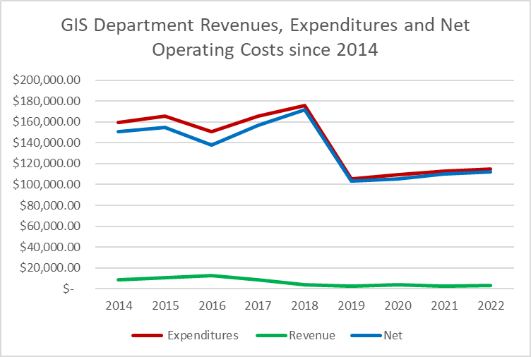
Departmental Financials

The chart below tracks our fiscal performance since 2014. Note the significant reduction in operating costs starting in 2019. Detailed breakdowns are available via the Finance Department.

A line graph titled "GIS Department Revenues, Expenditures and Net Operating Costs since 2014." It tracks three financial metrics over time, showing a significant drop in both expenditures and net costs starting in 2019.

Active Long-Term Projects

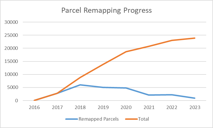
Parcel Remapping Accuracy Initiative

Goal: Improve parcel data accuracy to within +/- 3 feet. This is a multi-year effort dependent on identifying accurate section corner coordinates.

Project Progress
84.5%
Parcels Remapped
0
Total County Parcels
0
A line graph titled "Parcel Remapping Progress" showing data from 2016 to 2023. An orange line represents the cumulative total of remapped parcels, rising steadily to nearly 25,000. A blue line shows the number of parcels remapped each year, peaking in 2018.