The St Joseph County GIS Department produces a variety of presentation quality maps in support of local government activities within the county. Below is a sampling of our more popular maps. All maps available here are provided FREE to download in digital .PDF format. Hardcopies are not available from the county. Provide your local print shop a copy of the .pdf for pricing to have these wall maps printed.
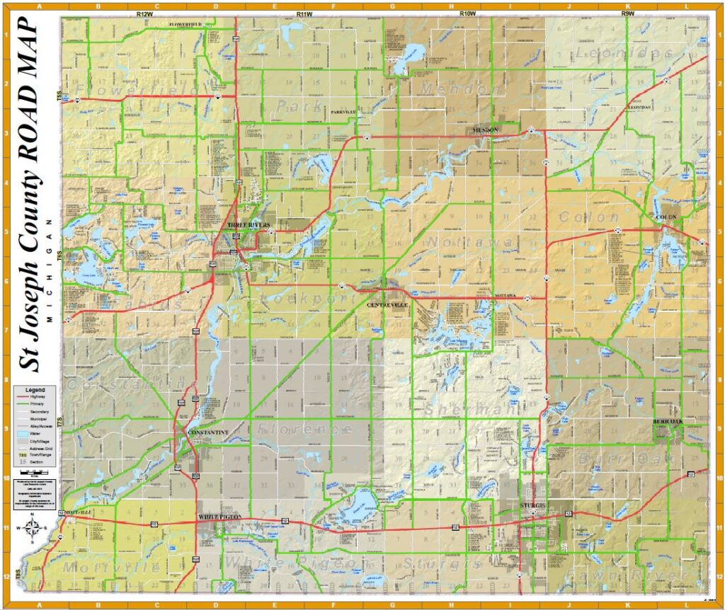
St. Joseph County Road Map
Large format County Road Map (43″ wide x 36″ tall). Includes roads, road names, lakes, rivers, cities, villages, townships, sections, address ranges and more. Click on the image below to download .pdf (will open in new window).
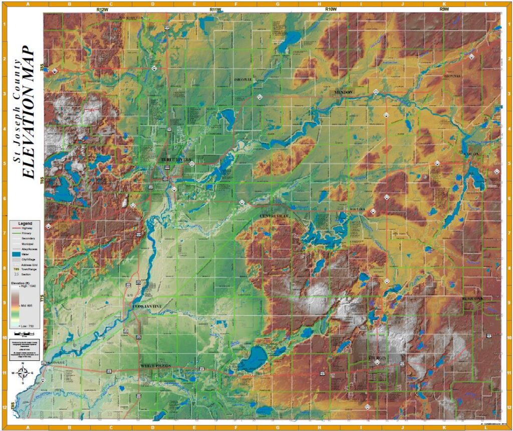
St. Joseph County Elevation Map
Large format County Elevation Map (43″ wide x 36″ tall). Shaded relief map showing elevations color coded. Shading is exaggerated to enhance the detail. Includes roads, road names, lakes, rivers, cities, villages, sections, address ranges and more. Click on the image below to download .pdf (will open in new window).
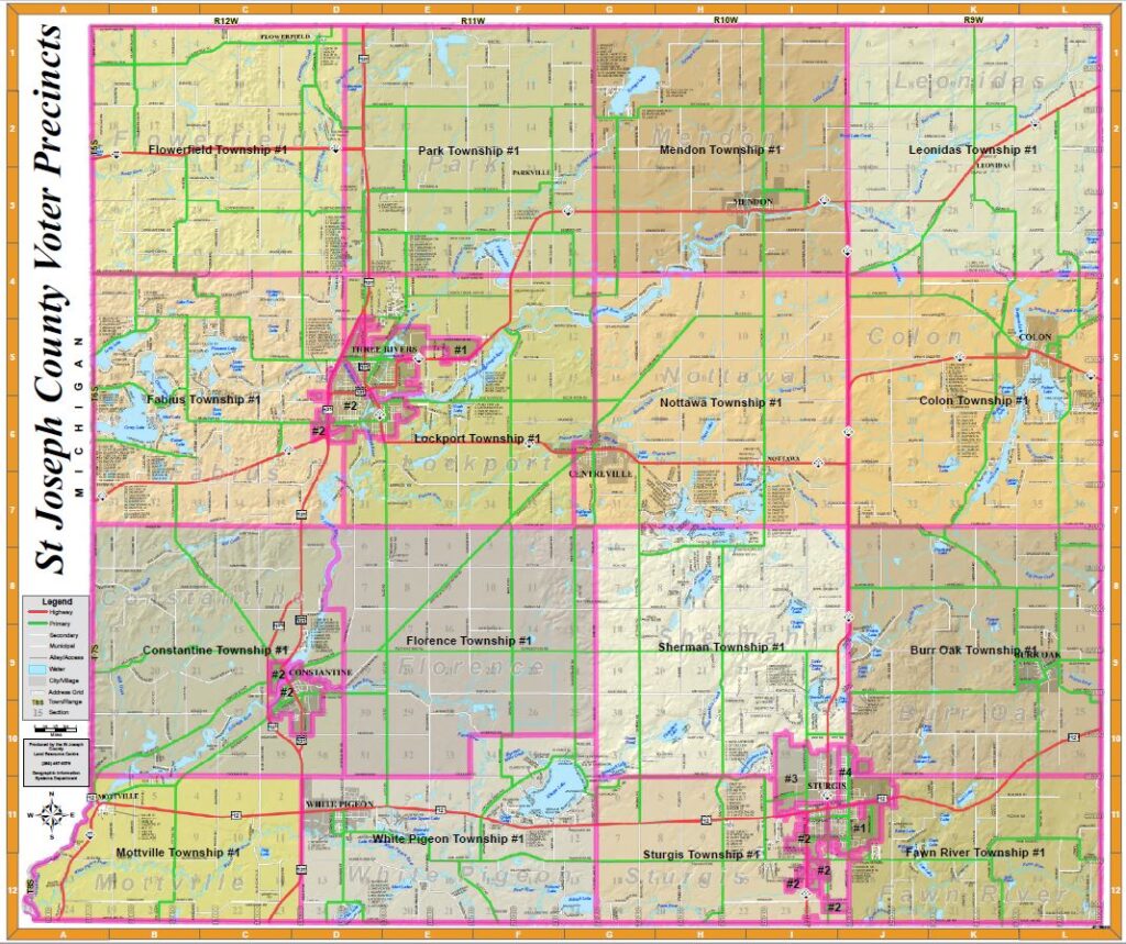
County Voting Precincts Map
Large format County Map (43″ wide x 36″ tall). County Road Map showing Current Voting Precincts. Click on the image below to download .pdf (will open in new window).
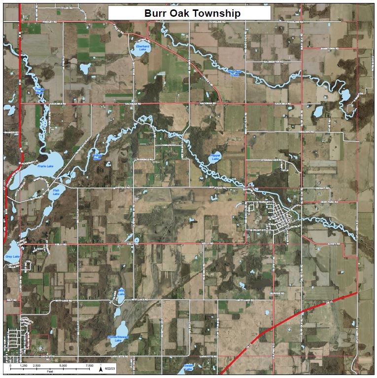
2019/20 Air Photo Street Map Series
Maps of each city, village and township showing streets over 2019/2020 air photos. Each map is 18″x18″ but are suitable for enlarging.. Click on the image below to download all 24 maps in one .pdf document (will open in new window).
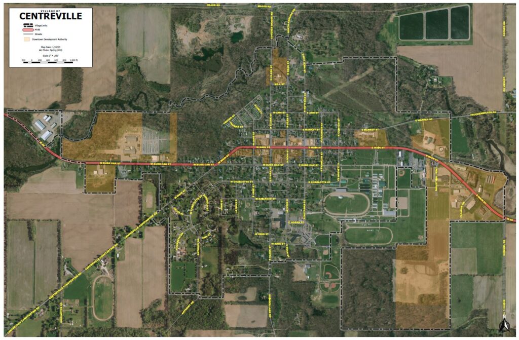
Village of Centreville Downtown Development Authority & Street Map
Large format Village Street Map (54″ wide x 42″ tall). Includes village streets, 2019 air photo and DDA district. Click on the image below to download .pdf (will open in new window).
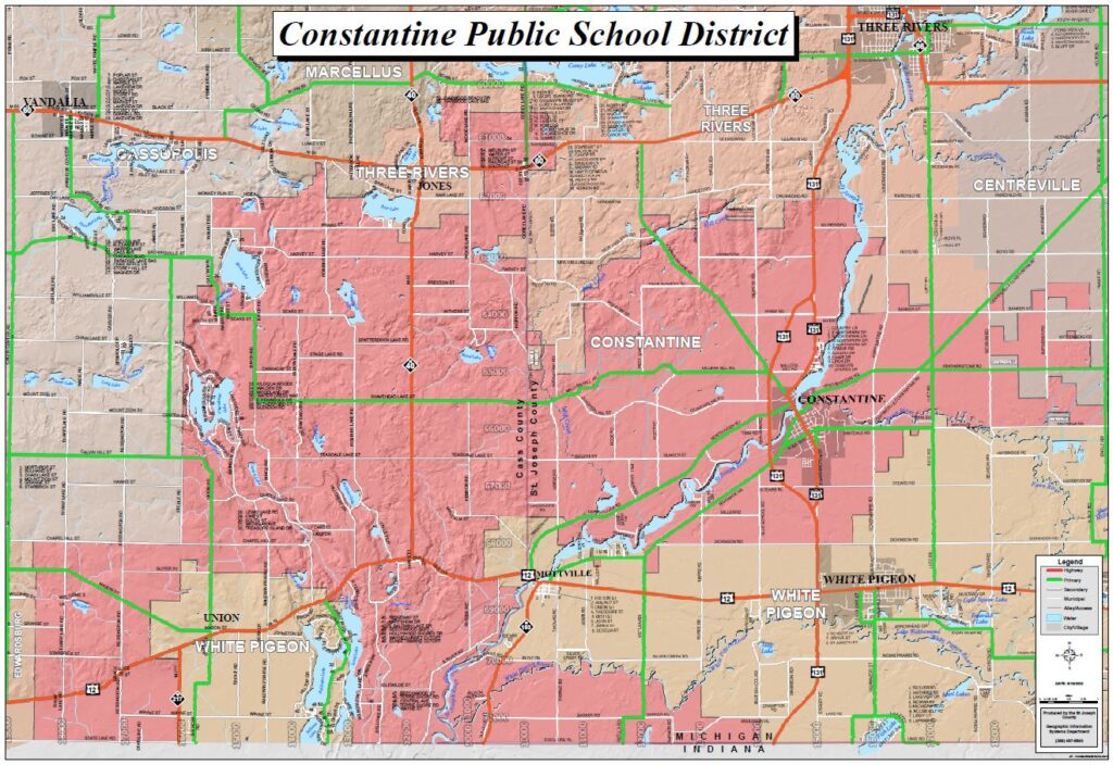
Constantine Public Schools District Map
Constantine School District Map (36″ wide x 24″ tall). Shows school district boundaries, roads and topology. Includes neighboring school districts names. Click on the image below to download .pdf (will open in new window).
Soils & Wetland Reports Maps
These are county-wide soil and wetlands maps suitable for including in a report to demonstrate the availability of GIS soils and wetlands data for analysis purposes. These 8.5×11 maps are too small to convey any useful information, but are nice graphics demonstrating that we do have access to this type of data and can conduct meaningful analysis with it as needed.
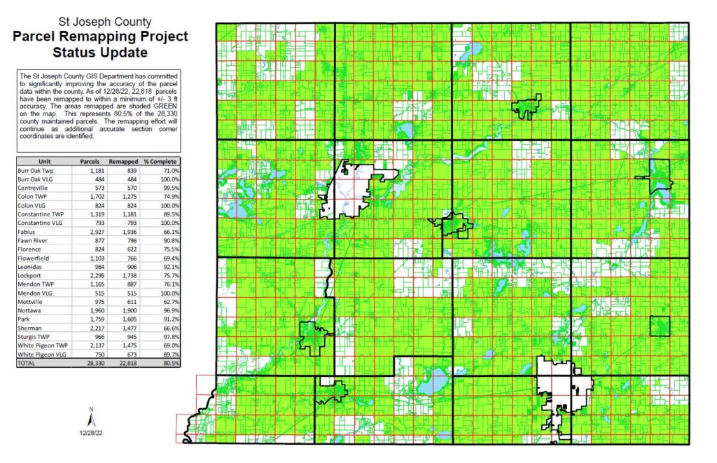
County Parcel Remapping Project Status Update Map
County Parcel Map (17″ wide x 11″ tall). Highlights parcels remapped as part of the GIS Departments ongoing efforts to improve parcel data quality throughout the county. Click on the image below to download .pdf (will open in new window).
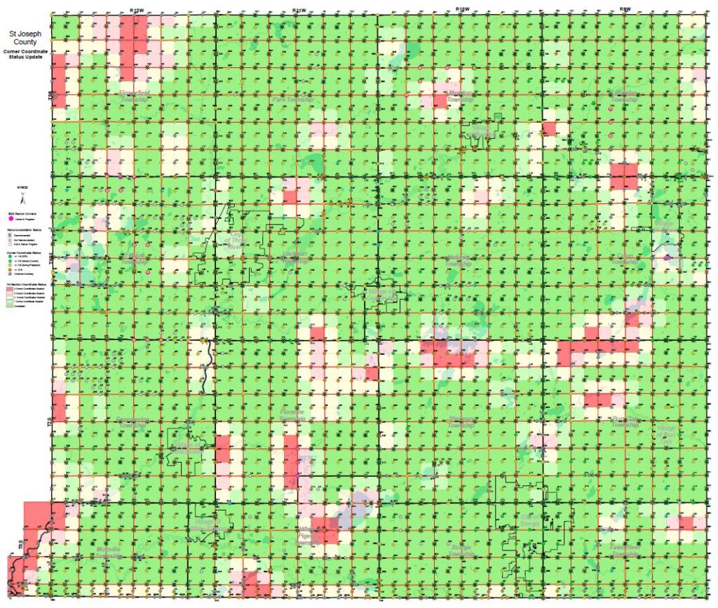
Remonumentation Project Status Map
County Section Corner Map (28″ wide x 24″ tall). Displays completion status of section corners in the Remonumentation Program. Includes details on estimated corner coordinate accuracy and 1/4 section mapping accuracy status. Click on the image below to download .pdf (will open in new window). An interactive map with similar information is available in the Interactive Map Portal.
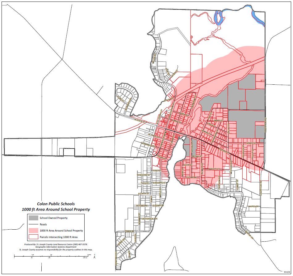
100' School Zone Buffer Area Maps
A series of maps depicting 1000-foot buffer zones around school properties (various sizes). Click on the image below to download .pdf (will open in new window).
More To Come!
More free wall maps will be released in the future, so check back later!