If you spot a helicopter towing a massive, hoop-shaped frame over Southwest Michigan this summer, there is no need for alarm. This unusual sight is part of the Hydrologic Enhancement for Michigan (HEMI) project, a scientific collaboration between the Michigan Department of Environment, Great Lakes, and Energy (EGLE) and the U.S. Geological Survey (USGS).
The project began around the second week of April 2026 and will be continuing for three to four months. These teams will conduct airborne electromagnetic (AEM) surveys across 15 to 16 counties to map our vital underground water resources.
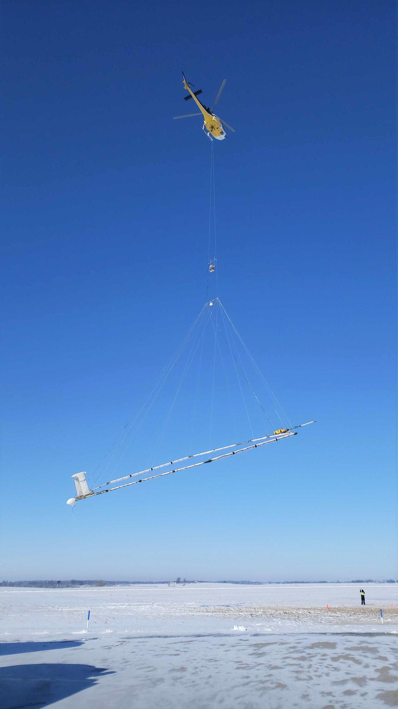
What You’ll See in the Sky
You may notice a helicopter flying approximately 200 feet above the ground at 50 mph. Suspended 100 feet below it is a sensor hoop—a high-tech tool over 60 feet in diameter and weighing 2,000 pounds. To collect accurate data, pilots follow a specific grid, so you may see the helicopter pass over the same area several times.
The Science
The AEM survey uses gentle magnetic pulses to “see” up to 1,000 feet below the surface. By measuring how well the ground conducts electricity, scientists can create a 3D map of rocks, sediment, and aquifers.
This data is crucial because 44% of Michigan residents rely on groundwater for drinking water. Understanding these hidden systems helps state managers protect the water used for homes, local farms, industry, and the natural flow of our rivers and lakes.
Safety First
The survey is completely safe for humans, plants, and livestock.
- Low Exposure: The magnetic field generated is less than 1/100th of the accepted public exposure level—roughly equivalent to standing a foot away from a kitchen toaster.
- Strict Regulations: Following FAA rules, the helicopter will not fly within 500 feet of buildings.
- Expert Piloting: No cameras are used, and pilots will actively fly around people, livestock, and large equipment.
See it Up Close
If you want to see this technology in person and speak with the researchers, you are invited to a public demonstration.
- When: Tuesday, May 19, at 10 AM
- Where: Brooks Field Airport, 1243 S. Kalamazoo Ave., Marshall, MI
Attendees can watch a demonstration takeoff and learn firsthand how this cutting-edge science is securing Michigan’s water future.
Track the Progress
Curious about where the helicopter is right now? You can access the USGS Flight Tracker and the Southwest MI AEM Survey webpage through EGLE’s HEMI project website. There, you can also find recordings and slides from the January 2026 Local Officials webinar for a deeper dive into the project’s planning and science.